
Track. Explore. Connect.
Real-time amateur radio satellite tracker: live map, pass predictions and Doppler
See where 95 amateur radio satellites are right now, when they pass over your grid locator and which frequency to tune during the pass. Free, in the browser.
What it does
-
Live map of amateur satellites
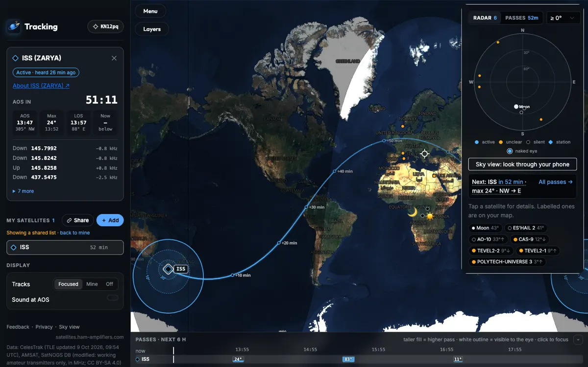
Every satellite in the catalogue on a full-screen map. Click one to see its ground track for the next orbit and its radio footprint, with rings where it is 10° and 30° above the horizon.
-
Pass predictions for your station
Passes for the next 24 hours over your Maidenhead locator or GPS position: AOS, maximum elevation, LOS, direction and a countdown. A timeline under the map shows the next 6 hours.
-
Doppler-corrected frequencies
Uplink, downlink and beacon frequencies with the live Doppler correction and the shift in kHz, so you know where to tune at this moment of the pass.
-
Live AMSAT status
Satellites heard in the last 24 hours are marked active, from AMSAT reports. Recent reports are shown on the map at the grid square of the operator who sent them.
-
Radar of your sky
A polar chart of everything above your horizon, not only your selection, plus the Moon. On a phone it can turn with the compass and point you to the satellite you picked.
-
Sky view on your phone
Hold the phone up and satellites are drawn where they are in the sky, following the compass, tilt and roll, over the camera picture if you turn it on.
-
Zones, terminator and the Moon
CQ and ITU zones, the day/night terminator, Sun and Moon. Click the Moon for its position, rise and set times, and EME path loss and echo Doppler on 144, 432 and 1296 MHz.
-
Satellite pages and shareable links
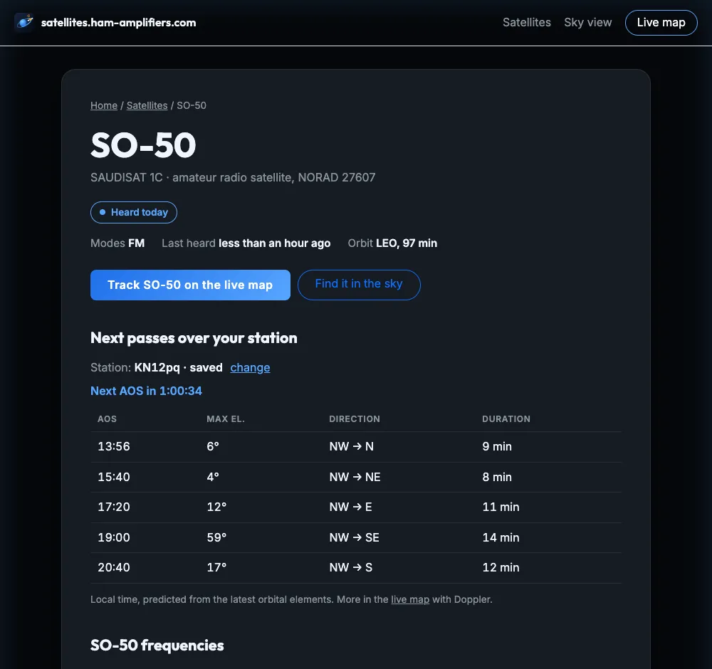
Each satellite has a page with its frequencies, status, orbit and next passes. The map address keeps your selection, so you can send a link with the same satellites to a friend.
What it looks like
Popular satellites
How to get started
-
Set your station
Open the live map and type your Maidenhead locator or coordinates, or press Use GPS. Pass times and Doppler are calculated for this point.
-
Pick satellites
Press + Add and search by name, NORAD ID or frequency, or filter by Heard today, FM, Linear or Digi. FM satellites heard today are the easiest place to start.
-
Catch the next pass
The Passes tab shows when each satellite rises and how high it gets; higher passes are easier. For an FM satellite, a dual-band handheld and a small Yagi are enough: listen on the downlink and point the antenna using the radar or Sky view.
Questions
- Is the satellite tracker free?
- Yes. The live map, pass predictions, Sky view and satellite pages are free to use, and you do not need an account.
- Do I need to install anything?
- No. It runs in the browser on a computer or a phone. Satellite positions and passes are calculated in your browser from the orbital elements (TLE). The map needs WebGL, which current browsers have.
- How do I set my location?
- Type your Maidenhead locator (for example KN12pq, 4, 6 or 8 characters) or coordinates such as 42.69, 23.32 into the station form, or press Use GPS. A location you type is remembered in your browser and used on your next visit instead of asking for GPS.
- Which satellites can I work with a handheld?
- FM satellites: they carry a single-channel FM repeater, so a dual-band FM handheld is enough, ideally with a small handheld Yagi. Look in the FM section of the satellite list and pick ones marked Heard today. Linear transponders need an SSB/CW radio, and digital satellites need a TNC or software.
- Where do the frequencies and statuses come from?
- Orbits come from CelesTrak. Frequencies come from SatNOGS DB under CC BY-SA 4.0, modified to keep working amateur transmitters only, in MHz. Status comes from AMSAT reports by operators: a satellite is active when someone reported hearing it in the last 24 hours.
- Does it work on a phone?
- Yes. On a phone the map menu becomes a panel at the bottom that you pull up, and Sky view uses the compass and motion sensors to show satellites where you point the phone, over the camera picture if you like. Without a compass you can look around by dragging.